Powerful Storms and Flash Flooding Expected from Midwest to Rockies as Weather Front Intensifies
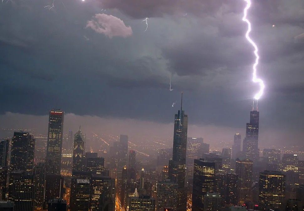
A volatile clash of air masses is setting the stage for widespread severe weather across parts of the Midwest and Central Plains on Wednesday, with the greatest risks spanning from Chicago and Milwaukee westward to Denver and the eastern Rocky Mountain region.
According to forecast models, a frontal boundary stretching from the Great Lakes to the Rockies will trigger a band of unstable weather, prompting the Storm Prediction Center to issue a Level 2 (Slight Risk) for severe storms across portions of Illinois, Wisconsin, and Colorado.
Cities included in the eastern threat zone are Chicago, Milwaukee, Green Bay, Peoria, and Davenport, while the western region covers Denver and Cheyenne. Forecasters anticipate the most intense activity will occur during the afternoon and evening hours, when daytime heating and atmospheric instability are expected to reach their peak.
The storms could bring hail, damaging wind gusts, and isolated tornadoes, but the primary hazard is expected to be strong straight-line winds sweeping from west to east. As the sun sets and temperatures cool, the severe weather threat is expected to diminish overnight, though localized impacts may linger into early Thursday.
In addition to severe storms, the region is bracing for flash flooding as high dew points and elevated precipitable water values create conditions ripe for heavy downpours. Forecasters warn that any thunderstorm that forms could dump 1 to 2 inches of rain in a short span, overwhelming drainage systems and causing dangerous water accumulation.
Areas around Chicago and Davenport have already faced significant flooding in recent days, with Flash Flood Warnings and Emergencies issued for communities hit hard by intense rainfall. Authorities are urging residents to take flash flood risks seriously.
“Just six inches of fast-moving water can knock an adult off their feet,” officials noted, while a foot of floodwater is enough to stall or sweep away a vehicle. According to historical data from NOAA, flooding claims an average of 127 lives per year, nearly half involving vehicles caught in rising water.
On the air quality front, the storm system may provide some relief. Lingering wildfire smoke from Canada, combined with summer ozone pollution, had degraded air quality across parts of the Midwest, prompting health advisories earlier this week.
In Chicago, officials declared an Air Pollution Action Day on Tuesday as ozone and particle levels reached unhealthy ranges, particularly for children, seniors, and those with respiratory conditions. The approaching rain and cooler air are expected to clear out pollutants, at least temporarily.
Once the front clears the region, a brief period of milder weather is expected. Forecasts show highs dipping into the 70s by Friday, followed by a return to low-to-mid 80s over the weekend, ahead of another system that could bring renewed rain and storms into early next week.
Residents in affected areas are urged to monitor local weather alerts, review flash flood preparedness plans, and avoid travel during intense rainfall events. Emergency officials emphasize that flood-related deaths are preventable, and early action can save lives.


Sign in to join the conversation
LOGIN TO COMMENT