Rain and Thunderstorms Expected to Disrupt Tuesday Morning in NYC Before Clear Skies Return
Cloudy Start to the Day May Give Way to Flash Flooding in Some Areas
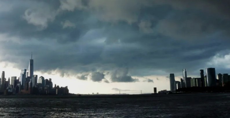
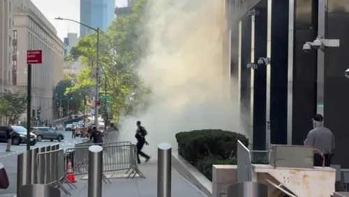
New York City and surrounding counties are expected to see a round of rain and thunderstorms early Tuesday, with weather officials warning of localized flooding in low-lying areas. This weather event may bring temporary travel disruptions and reduced visibility across the region.
Forecasters have issued a weather alert for Tuesday morning through early afternoon, urging residents to stay cautious during the most active hours of the storm system.
Timeline of the Storms and Rainfall Estimates
The day begins under a gloomy sky, with mist, drizzle, and heavy cloud cover setting the tone. However, conditions are expected to intensify between 7:00 a.m. and 12:00 p.m., when a line of moderate to heavy thunderstorms could sweep through the New York metro area.
While the risk of severe weather is considered low overall, isolated strong storms may still develop during the late morning hours. Rainfall totals are expected to average between 0.5 to 1 inch, but pockets of heavier rainfall could push those numbers higher in certain neighborhoods.
Areas Under Flood Advisory
A flood advisory was issued earlier in the day for multiple counties, including:
Westchester
The Bronx
Bergen
Essex
Hudson
Union
New York County (Manhattan)
This advisory was in effect until 12:15 p.m., coinciding with the most intense rainfall forecast for the morning hours.
Rain Clears Out and Sunshine Returns
Despite the soggy morning, weather models predict a swift clearing of the skies by early afternoon. As the storm front exits the region, sunshine is expected to return, with only a slight chance of a stray shower or thunderstorm lingering behind.
Temperatures will climb back to seasonal averages, with highs reaching the mid-to-upper 70s. Humidity will remain noticeable through the day but is expected to ease up as evening approaches.
Pleasant Night and a Warmer Week Ahead
As skies clear Tuesday night, cooler and drier air will move in, bringing lower humidity and more comfortable overnight temperatures. Lows will dip into the upper 50s to mid-60s, making for a mild and refreshing night across the city.
On Wednesday, a fresh air mass will settle in, delivering sunny skies, reduced humidity, and warmer daytime temperatures. Highs are expected to rise into the low-to-mid 80s, offering a perfect preview of summer weather.
Rising Temperatures Expected by Thursday
Looking further ahead, Thursday is set to be the warmest day of the week so far. Many parts of the city and surrounding areas could see temperatures soaring into the mid-to-upper 80s, with some spots potentially touching the low 90s.
This stretch of warm, dry weather will bring welcome relief for those who have outdoor plans or are hoping to enjoy the early signs of summer.
What Residents Should Know
Be cautious during the Tuesday morning commute. Roads may become slick, and localized flooding is possible.
Keep an umbrella and rain gear handy until at least midday.
Stay informed through local weather updates for any changes in advisory areas or storm timing.
Look forward to clear skies and rising warmth by midweek.


Sign in to join the conversation
LOGIN TO COMMENT