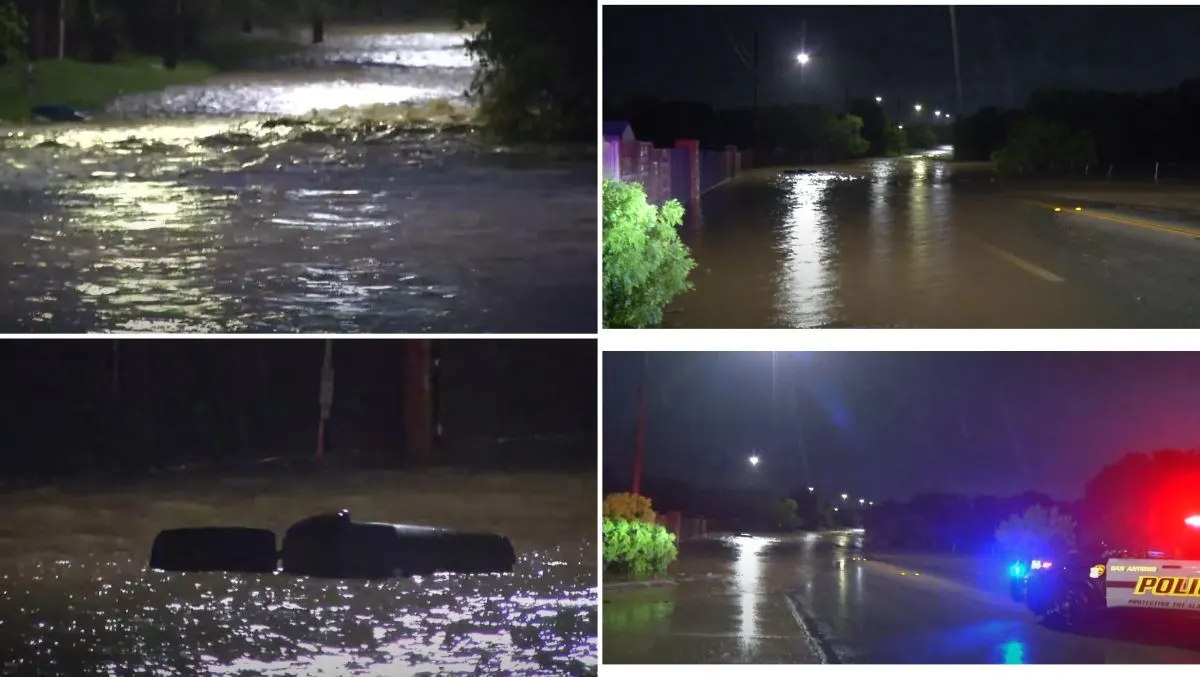
Torrential Rains Unleash Devastating Flash Floods Across Texas as San Antonio Grapples With Chaos
Heavy Rain Triggers Widespread Flooding and High-Water Rescues
Relentless downpours across Texas have led to severe flash flooding, triggering high-water rescues, widespread road closures, and a deadly multivehicle crash in San Antonio. The intense rainfall began late Wednesday night and escalated quickly by early Thursday morning, overwhelming drainage systems and turning roads into dangerous rivers.
Emergency crews were stretched thin as water levels surged across low-lying areas, sweeping away vehicles and trapping residents in submerged neighborhoods. The flooding, described by officials as some of the most aggressive seen in recent years, has already claimed lives and continues to threaten communities across multiple counties.
Fatal Crash Amid Floodwaters Raises Alarm
Around 5:00 a.m. local time, a fatal multivehicle collision occurred along the Loop 410 frontage road at Perrin Beitel in San Antonio. Authorities reported at least one confirmed death at the scene, though investigations are still underway to determine whether the crash resulted from road conditions or the rising floodwaters.
Initial reports suggest that three individuals may have died—one from the crash itself and two others who were swept away and later found downstream. Search and recovery efforts continue as emergency crews comb the area for missing vehicles and individuals possibly caught in the flooding.
Record-Breaking Rainfall in San Antonio and Beyond
San Antonio experienced more than 6.6 inches of rainfall over two days, with over 5.5 inches falling in just three hours, leading to rapid water accumulation across the city. Nearby New Braunfels recorded over 3 inches of rain in a mere 30 minutes, overwhelming streets and low-water crossings.
Videos captured from Santo, Texas, showed alarming scenes of fast-rising waters and residents being evacuated under challenging conditions. Footage from Panama Road displayed dramatic rescues by first responders as water levels climbed to four feet in some neighborhoods.
City Infrastructure Stretched to Its Limits
By early Thursday, the San Antonio Fire Department had conducted over 20 high-water rescues, and numerous roads had been shut down. Leon Creek, near Loop 410 in the Leon Valley area, surged by an astonishing 13 feet in just two hours, channeling more than 41,000 cubic feet of water per second—a clear indication of the storm’s intensity.
As the region continues to deal with widespread disruption, emergency services have urged residents to avoid travel unless absolutely necessary, especially in flood-prone areas.
Flash Flood Threat Expands Toward Houston and Ark-La-Tex Region
The storm system, powered by an unusually moist atmosphere and stagnant upper-level winds, has created a highly unstable weather environment, primed for slow-moving thunderstorms and torrential downpours. The result: dangerously high rainfall rates and a continued flood threat through the end of the week.
On Thursday, forecasters issued a Level 3 out of 4 flash flood threat for the Houston area, with the risk expanding eastward into Arkansas and the greater Ark-La-Tex region by Friday. The National Weather Service reported that over 40 low-water crossings had already been closed across Bexar County, with additional closures in Comal and Hays counties.
A Stalled Front Fuels the Deluge
A cold front stalled across the region has become the focal point for continued rounds of rainfall. This boundary, combined with strong storm energy and ample atmospheric moisture, is expected to fuel additional thunderstorms capable of producing flash floods, particularly in areas already saturated from previous spring storms.
Meteorologists warn that these conditions are ideal for training storms, where multiple thunderstorm cells move over the same area repeatedly, dramatically increasing rainfall totals and the risk of flooding.
Residents Urged to Stay Alert as Conditions Worsen
Local authorities and emergency services are urging residents across central and southeastern Texas to remain vigilant, avoid flooded roadways, and monitor official updates. With more rain on the horizon and storm activity expected to intensify, the threat of additional flash flooding remains dangerously high.
Officials continue to monitor the situation closely, and resources are being mobilized across the affected regions to assist with evacuations, rescues, and recovery efforts. Communities from San Antonio to Houston and into Arkansas are being advised to prepare for further weather-related emergencies in the coming days.
As Texas battles this severe weather crisis, the resilience of first responders and local communities has once again come to the forefront. With quick action, coordinated efforts, and continued public awareness, the state hopes to minimize further loss and emerge stronger from the aftermath of this devastating storm system.


COMMENTS (0)
Sign in to join the conversation
LOGIN TO COMMENT