Severe Flood Watches Issued for Chicago Area as Heavy Rain Approaches
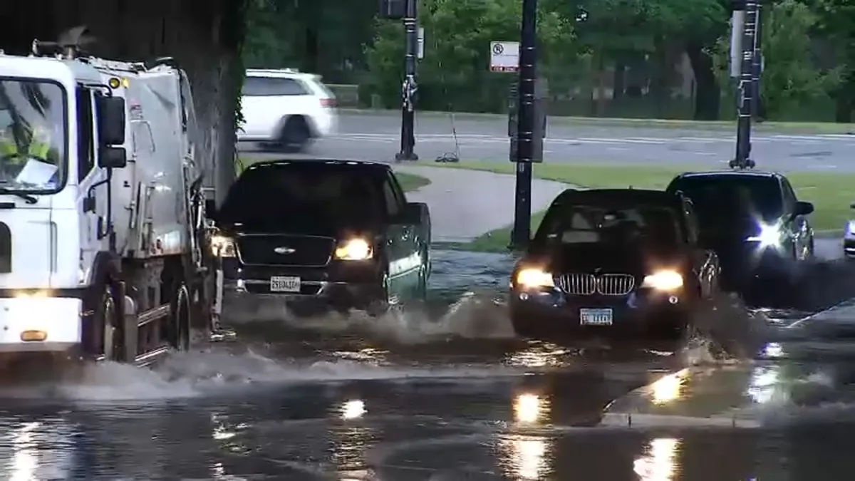
Significant Rainfall Anticipated Friday Night Through Saturday Morning
The Chicago area braces for potential flooding as the National Weather Service has issued a flood watch effective from 10 p.m. Friday until 10 a.m. Saturday. Heavy rainfall is predicted to arrive overnight, particularly impacting areas south of Interstate 80.
This watch encompasses not only the city of Chicago but also suburbs extending to Naperville and Calumet City. Meteorologists are warning that creeks and streams could overflow their banks, triggering hazardous conditions in urban areas that experience poor drainage.
Reservoirs and Flood Control Systems at Risk
As the storm approaches, the Deep Tunnel flood control system and its associated reservoirs are already feeling the strain. As of Friday evening, the Thornton Reservoir is reportedly 75% full, holding approximately 6.3 billion gallons of stormwater. Meanwhile, the McCook Reservoir is even closer to capacity at 90%, containing about 4.6 billion gallons.
This summer has witnessed some of the most severe storms in the Chicago area in recent memory, leading to extensive flooding and damage to homes. For the first time, the reservoirs designed to manage stormwater are nearly full—a stark indicator of the ongoing challenges posed by severe weather conditions.
Ground Saturation Heightens Flood Risks
Weather service meteorologist Brett Borchardt emphasizes that the ground is currently saturated and unable to absorb much more water. "That’s what’s setting the table for the potential flash floods tonight," Borchardt remarked. He noted that even small amounts of rain could lead to significant flooding due to the cumulative effects of previous storms.
Looking towards Central Illinois, forecasts indicate that this area may experience the most severe impacts from the incoming storm, having received heavy rain Thursday night. While Chicago and the northern suburbs will still face rainfall, the southern regions are expected to see the most extensive flooding.
Community Preparedness and Ongoing Warnings
The flood watch was first issued earlier this week, amid warnings that residents in southern suburbs and northwest Indiana are still dealing with the aftermath of severe storms and tornadoes experienced earlier this summer. The community remains on high alert as the potential for additional flooding threatens previously affected areas.
As the storm progresses, local residents are encouraged to remain vigilant. Many may awaken to thunder and rainfall as early as 3 or 4 a.m., prompting calls for caution as they navigate potential flooding.
Current Situation and Next Steps
With the flood watch in effect, local authorities are monitoring conditions closely to respond promptly to any emergencies that arise. The situation remains fluid, and residents are advised to stay updated on weather forecasts and alerts.
📰 Related Stories
- Mayor Brandon Johnson Unveils 2027 Budget Engagement Report with UIC Ahead of Crucial City Council Fiscal Address Chicago • Oct 19, 2026
- Chicago Transit Authority Advances Historic $3.6 Billion Red Line Extension with $1.97 Billion Federal Grant Agreement Chicago • Oct 18, 2026
- Mayor Brandon Johnson Prepares 2027 Chicago Budget Address Following Council Debt Veto Win and Corporate Tax Push Chicago • Oct 18, 2026
- Dallas City Council Debates $443M Proposition A Safety Bond as Mayor Eric Johnson Champions Innovation and Efficiency Dallas • Oct 19, 2026