Central Indiana Braces for Patchy Freezing Fog and Cold Temperatures as Weekend Snow Likely
Overview
Central Indiana is bracing for patchy freezing fog and bitterly cold temperatures today, with wind chills below zero across northern areas.
Northern Indiana saw a frigid morning as clear skies, light winds, and a deeper snowpack allowed temperatures to drop into the single digits before daybreak, with a few locations near zero. Patchy freezing fog was possible across the far northwest portions of the state early today.
Farther south, a stubborn stratus deck extending up to the I-70 corridor kept temperatures milder overnight, generally in the teens and 20s, and clouds may linger into the afternoon before thinning.
Today’s conditions
Wind chills early today will be harsh across the north, near zero. Today, gradual clearing and an increasing southwesterly breeze will push afternoon highs to the upper 20s in the north to the mid-30s in the south.
Weekend forecast
A weak front crosses the region during the day Saturday. A few flurries or an isolated snow shower are possible. Accumulation is unlikely, but a brief dusting cannot be ruled out.
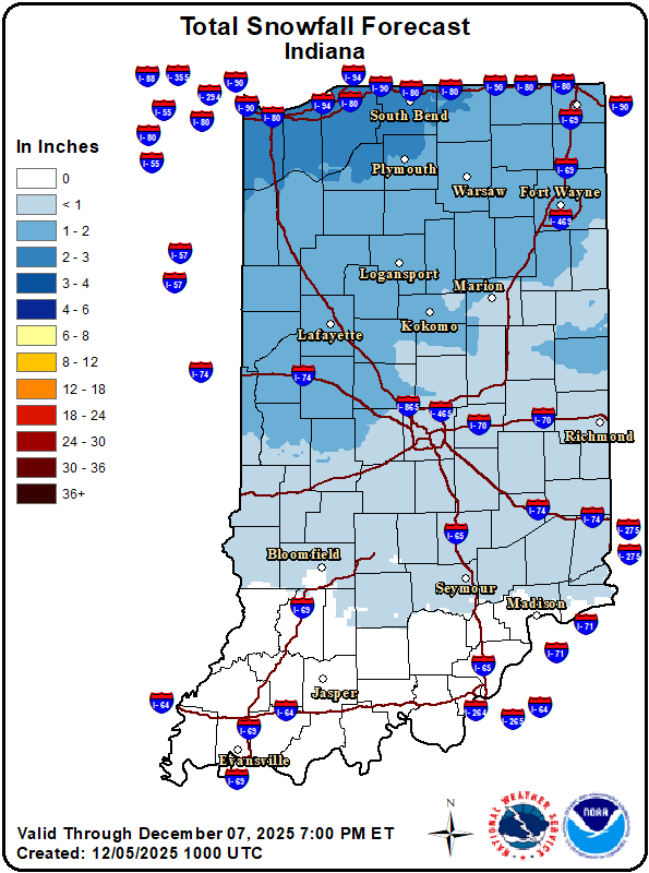
Sunday snow chances
A developing upper-level disturbance arrives late Saturday night into Sunday. Snow at the start for most areas, with a transition to rain likely Sunday for southern counties as temperatures rise. Snow accumulation potential ranges from trace to 2 inches, with the highest totals on Sunday morning for northern portions of the state.
Next week forecast
Two systems move through the area midweek. Rain is favored Tuesday and Wednesday daytime. Winds look to ramp up as well. Another system moves in Thursday that could bring in another round of snow and cold temperatures.


COMMENTS (0)
Sign in to join the conversation
LOGIN TO COMMENT