Flood Watches Cover Jacksonville and Northeast Florida as Rainbands and St. Johns River Surge
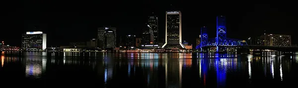
Onshore Winds and High Tides Trap Floodwaters Along Coast and Riverbanks
JACKSONVILLE, Florida — The National Weather Service maintained flood watches and warnings across Jacksonville and Northeast Florida—including Duval, St. Johns, Clay, Flagler, and Putnam counties—on November 20 as heavy coastal rainbands continued pushing northward. Forecasters projected an additional 2 to 6 inches of rain along the I-95 and U.S. 17 corridors, with isolated totals up to 8 to 10 inches.
Elevated St. Johns River Levels Expected to Recede Slowly Into Next Week
Because the St. Johns River is already running well above historic flood marks upstream while flowing north over flat terrain, easterly wind gusts up to 40 mph and high tides are blocking normal drainage into the Atlantic. Emergency officials urged drivers to avoid flooded streets as high river stages are expected to linger into early next week.
📰 Related Stories
- UF Jacksonville LaVilla Campus Wins Unanimous Design Approval as JTA Advances $47M Recovery Plan Jacksonville • Nov 21, 2026
- Flood Warnings Cover Jacksonville and Northeast Florida Ahead of Nights of Lights Kickoff Jacksonville • Nov 20, 2026
- Flood Warnings Cover Jacksonville and Northeast Florida Ahead of Nights of Lights Kickoff Jacksonville • Nov 20, 2026
- Verstappen Takes Las Vegas Grand Prix Pole After Antonelli Penalty as M&M's Flagship Plans Renovation and Knights Hit Road Las Vegas • Nov 21, 2026