Torrential Storms Trigger Widespread Flash Floods Across New York and New Jersey
Heavy rainstorms battered New York City and surrounding areas on Monday, July 15, unleashing flash floods, overwhelming transit systems, shutting down highways, and grounding air traffic. The storm system stretched from Virginia to Pennsylvania, with some regions receiving up to seven inches of rainfall in a matter of hours.
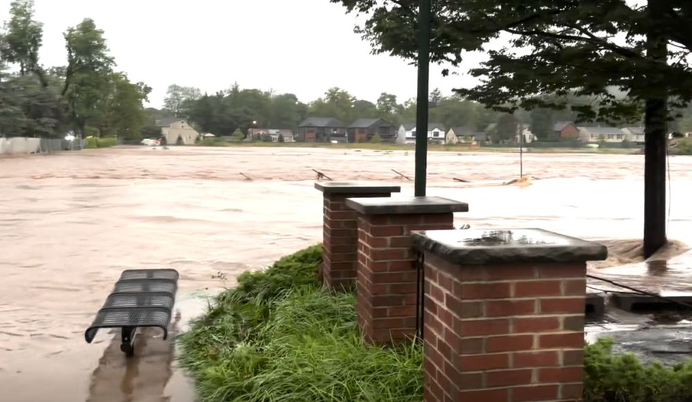
The National Weather Service issued flash flood warnings for all five boroughs of New York City, as well as large portions of central and southeastern Pennsylvania and central New Jersey. In response, New Jersey Governor Philip D. Murphy declared a state of emergency, as roads became impassable and rescue operations were launched in flood-stricken neighborhoods.
In New York City, the storm caused chaos throughout the evening. Subway stations flooded, with videos showing water pouring down stairwells and onto platforms. At the height of the storm, service was suspended on the 1, 2, and 3 subway lines, though the Metropolitan Transportation Authority (MTA) restored operations shortly before 11 p.m. The Staten Island Railway also resumed after a temporary shutdown.
Power outages hit pockets of the city, including Richmond Hill in Queens, where nearly 1,000 residents lost electricity due to waterlogged infrastructure and damaged overhead power lines.
Major highways were swamped. In Mount Pleasant, New York, both directions of the Taconic State Parkway and Sprain Brook Parkway were closed due to rising waters. Meanwhile, bus routes and rail lines operated by NJ Transit faced delays and diversions, although service between New York’s Penn Station and Trenton, New Jersey, resumed normal operations later in the night.
In Plainfield, New Jersey, the city's train station—serving Manhattan-bound commuters—was reported to be completely flooded and impassable, while in Saddle River, Bergen County, flood watches extended through Tuesday afternoon.
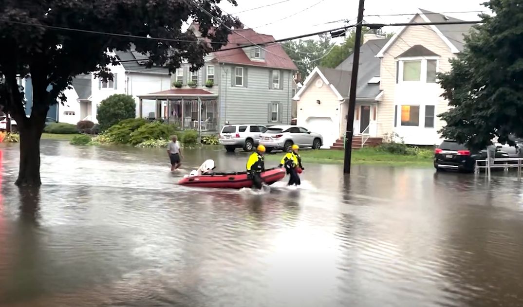
In Union County, New Jersey, particularly in New Providence, roadways disappeared under water, forcing authorities to carry out multiple water rescues. Kelly Martins, a county spokesperson, confirmed major highway closures and ongoing emergency response efforts. No fatalities were reported as of late Monday night.
Further west in Lancaster County, Pennsylvania, the borough of Mount Joy experienced one of the worst surges. Over seven inches of rain fell in less than five hours, according to local emergency management coordinator Philip Colvin. Emergency crews made 16 water rescues and responded to over 30 calls, with flooded basements and blocked roads particularly affecting the west side of town.
Air travel was equally impacted. John F. Kennedy International Airport reported departure delays exceeding three hours, while Newark Liberty International Airport saw delays of up to two hours, according to real-time tracking data. Passengers across the Northeast faced cancellations, extended waits, and rescheduled flights as the storm disrupted operations.
Although the storm system began to weaken by late Monday night, meteorologists warned that intermittent rainfall would continue into Tuesday, though not with the same intensity.
The storm marks yet another extreme weather event in a summer already marked by rising heatwaves and severe rainfall across the Northeast. City and state agencies urged residents in low-lying or flood-prone areas to remain cautious and have evacuation plans in place as urban infrastructure struggles to cope with climate-driven weather extremes.


Sign in to join the conversation
LOGIN TO COMMENT